
Google Earth might be the coolest of all the Google apps. It’s like Google Maps’ younger, more tech-savvy sibling. What other free, open source program gives you the ability to explore our shared planet, zooming from your home to a city on the other side of the globe or even to space—all in just a few clicks or taps?
In this article, we’ll show you how to measure distances, areas, and elevations on Google Earth. The first step is to choose a version of Google Earth to use. There are three main versions.

The quickest way to get started is to access Google Earth on the web by visiting earth.google.com from a supported web browser. Currently, supported browsers include Chrome, Firefox, Edge, and Opera.
Mobile device users can download the Google Earth app from Apple’s App Store or from the Google Play store.
And those of you who want access to more features can download Google Earth Pro. Despite the “Pro” in its name, this desktop application is free and available for PC, Mac, and Linux. Google Earth Pro includes historical imagery and the ability to import and export GIS data—features that the web and mobile apps lack.

How to Measure Distances with Google Earth
Before we get into how to measure distances in Google Earth, first a warning about accuracy. Volumes have been written on this topic, and the upshot is that positional accuracy in Google Earth isn’t perfect, especially over long distances. For most amateur users and uses, though, it’ll be good enough.

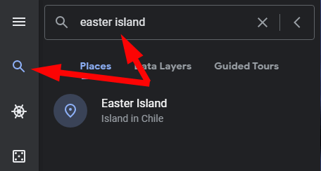
You will find that measuring the distance between two points on Google Earth is easy.
- Search for your starting point.
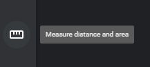
- Select the ruler in the toolbar.
- Select your starting point by clicking on the map.

- Select a second point on the map. The line between the two points will be yellow, and the distance between them will be displayed.

If you want to remove the last point you set, select Undo. You can also click and drag any points you’ve already set.
Units of Distance in Google Earth
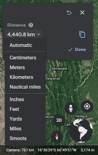
Google Earth will automatically choose the unit of measurement that makes the most sense for the distance you have measured. Alternatively, you can toggle between several units of measurement.
Select the dropdown arrow next to the distance, and choose your measurement unit. Options range from metric units like centimeters, meters, and kilometers, to imperial measurements like inches, feet, yards, and miles. You can also opt for nautical miles or even Smoots.
How to Measure Area with Google Earth
Measuring the area of a polygon in Google Earth is quite similar to measuring the distance between two points. Simply add three or more points and close the shape by selecting the first point.

The information panel will now display both the perimeter and the area of the shape you have created.
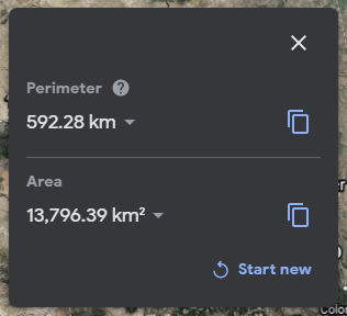
Again, you can change the unit of measurement by selecting the dropdown arrow next to each measurement.
How to Measure Elevation in Google Earth
Google Earth makes it really easy to find the elevation of any place on the planet. Simply select a point on the map, and the elevation will display in the lower-right corner of the map.

How to Measure Your House’s Height on Google Earth
Now that you know how to measure elevation, you can use that knowledge to calculate the height of your house (or any building) provided that Google Earth is rendering the building in 3D.

This exercise comes down to three steps:
- Determine the elevation of ground level by clicking on a point on the map at ground level. Note the elevation measurement of that point in the bottom-right corner of the map.
- Determine the elevation of the roof of the building whose height you want to measure by clicking on the roof of the building on the map. Note the elevation measurement of that point in the bottom-right corner of the map.
- Subtract the ground level elevation from the elevation of the roof, and that gives you the height of the building.
Measuring 3D Polygons with Google Earth Pro
If you’re using Google Earth Pro, you can go about this a different way.
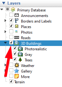
- In the Layers panel, make sure the box next to 3D Buildings is checked.
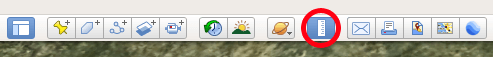
- Select the ruler tool.
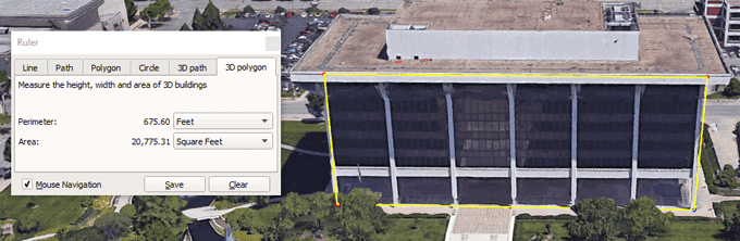
- In the Ruler pop-up window, select the 3D polygon tab.
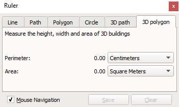
- Click on the map to set your points. You could select, for instance, the four corners of one side of a building. The Ruler panel will display the perimeter and the area of the polygon shape you have created. Again, you can use the dropdown arrows to select different units of measurement.
What Else Can You Do with Google Earth?
There’s so much more to Google Earth beyond measuring distances and areas. Launch the Voyager showcase and enjoy interactive tours, quizzes, and map layers.
Or, in true Google fashion, select the “I’m feeling lucky” icon, and Google Earth will whisk you away to a part of the world you’ve probably never heard of before. And, before you leave, be sure to learn how to launch the free Flight Simulator game that’s hidden inside Google Earth Pro!
source https://www.online-tech-tips.com/google-softwaretips/how-to-measure-distance-on-google-earth/